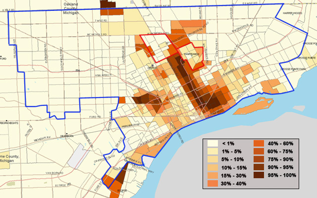
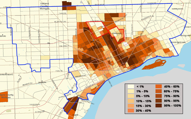
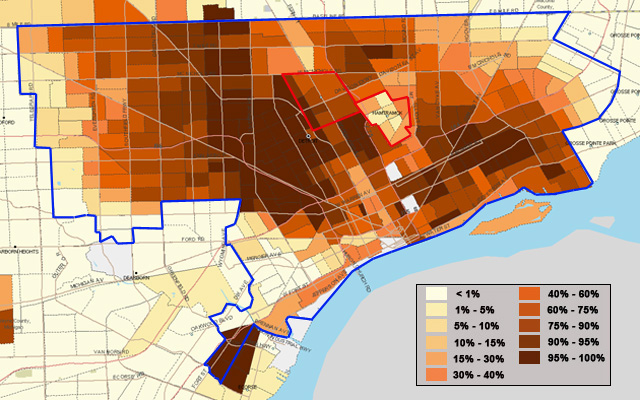
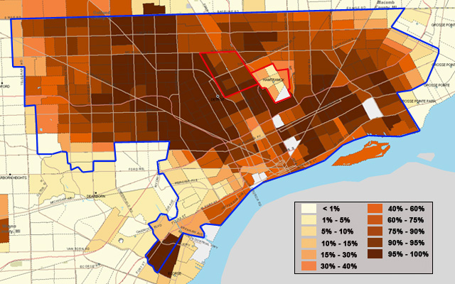
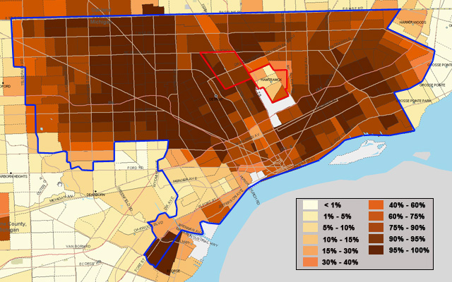
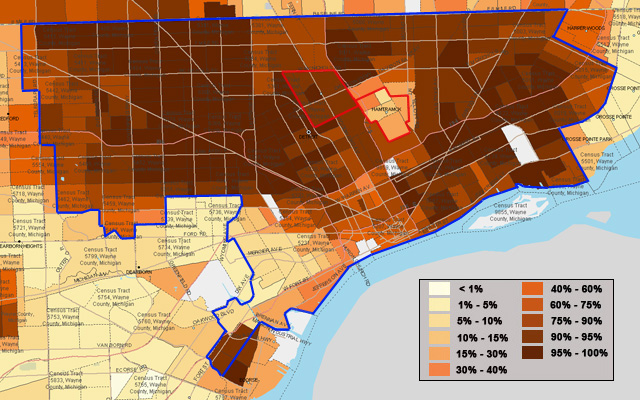
Jan. 11, 2012 — The maps below chart changes in racial demographic in Detroit from 1950 to 2010. The key in the lower right corner of each map explains the shading of each census tract. The areas outlined in red repreesnt the independent municipalities of Hamtramck and Highland Park.
The shading for the 1950 and 1960 maps reflect the percentage of African Americans in a census tract. Due to incomplete census data, the year 1970 is not included. From 1980 to the present, the shading reflects the percentage of non-Latino African Americans.
All mapping is courtesy of our colleagues at www.socialexplorer.com.

